

Finally, after three attempts at planning this trip, it was really happening — I was about to hike the so-called “Devil’s Mountain.”
For some reason, my previous plans never pushed through. The first was scheduled for October 2013, but before the climb date, our group ran into work schedule conflicts and had to cancel. I tried again in November, but just a day before our climb, Typhoon Yolanda struck, forcing us to postpone once more.
I couldn’t help but wonder if something was stopping our group from climbing this mountain — and interestingly, everyone in the team felt the same way. But this time, everything went smoothly, and we were beyond excited.
Mt. Cristobal is located within the borders of Quezon and Laguna. The main entry point is in Barangay Kinabuhayan, Dolores, Quezon, though there are also entry points and possible traverses from Nagcarlan, San Pablo, and Rizal.
We took a bus from GMA heading to San Pablo- take any Lucena bound buses.

The bus dropped us at Jollibee San Pablo because this where our rented jeep was waiting.

For those planning to do the Tala–Kinabuhayan Traverse, I highly recommend chartering a jeep. Public transportation to Tayak Hills, which is part of Tala, Rizal, is not readily available. While it’s possible to take a tricycle, expect to pay extra for the trip. The added cost is worth it for the group’s convenience — and it helps you stay on schedule.

This is the San Pablo Public Market where you can buy your supplies.

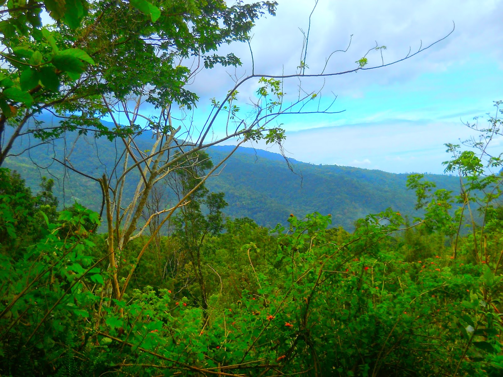
While heading to Tala Jump off this view stopped us because we saw the rare clearing of Mt. Banahaw and Mt. Cristobal which most of the time cloudy.

Of course our group wont miss this chance. Lets say! Cheese!
ESKAPO MOUNTAINEERS "TEAM CRISTRAV"

Behind is Mt. Cristobal. Thanks Totoy for taking our group picture.

The Seven Lake of Laguna from Tala Rizal.

Arrival at Jump Off. Registration and group positioning.

LORD GUIDE THE GROUP

This is where the traverse starts.

Mama Mary's Grotto will welcome you few steps from the jump off.

We started the trek at exactly 2:30 PM. We already knew what to expect from this traverse — the trail typically takes five to six hours to reach Jones Peak, the highest point of Mt. Cristobal, although that still depends on your group’s pacing. We set a goal to reach the summit before nightfall.

Before entering the forest line. You will pass by the Tayak Hills and this view is facing the Seven Lakes of San Pablo.

Our guide was Manong Jaime, one of the first locals of Mt. Cristobal. He knows everything about the mountain — every trail, every turn — and is even one of its original trailblazers. At 87 years old, he remains incredibly strong and full of life. Our group was truly amazed by him; his energy and kindness inspired us all.
Throughout the trek, he handled the group with ease and care. When we arrived at the jump-off, he even welcomed us into his home to rest and cooked for us himself. I highly recommend Manong Jaime as a guide for Mt. Cristobal. He eventually became a good friend of mine and is now my main contact person for the mountain.
(For inquiries, feel free to email me for his contact information.)

First leg of the traverse

The trek began with level terrain through a forest line. I noticed that the trail from Tala, Rizal, can be quite confusing, especially during the first stretch. There are so many branching paths that it’s easy to lose your way.
For first-timers doing the Mt. Cristobal traverse, I highly recommend getting a guide. At one intersection alone, there were three possible routes — two of which could lead you to Nagcarlan or San Pablo instead of the peak. You could always backtrack if you take the wrong path, but the lost time can make a big difference in your climb.
First Fork, take the steep and narrow trail to the left.

After the first fork you will pass a ruined nipa-hut. It means you are on the right trail.

From the kubo the trail is pretty-straight-forward and if you reached the intersection you will be welcome by three trails and take the middle trail.

From the intersection, we entered a steep trail that led us through a long stretch of banana forest. The path wasn’t very visible at first — fallen branches and layers of banana leaves covered most of the trail, making it tricky to follow.
As we continued, the trail gradually became clearer, especially when we reached Salalayan, which marks the beginning of the mossy forest.
Steep Trail through Banana Forest.

AYANG ANG ESKAPO

Quick break at Salalayan.

TEAM ESKAPO CRISTRAV ^_^

After a quick break we resumed the trek since we were targeting to summit Cristobal before dark. On the previous days it rained badly so the trail was slippery and muddy. When you entered the mossy forest you will feel that the temperature is getting colder. The forest was so dense and there is only minimal sunlight exposure.


The sun is about to sleep.

We failed to see the sunset because there were members who got sprained because of no practice and exercise. We had to pattern our pacing to their pacing because we want to summit together. In every climb we should not just gear-up ourselves but make sure that we are also physically fit and preprared.
Yet we still witnessed the total-sunset along the steep trail few meters away from the summit.

After 5 hours trek from Tala Trail we summit the Devil's Mountain- The Mt. Cristobal.
A breathe-taking view of San Pablo at night.

There are little space at the summit for camping but only two tents can be pitched. We wanted to camp there but there was a group who came first so we decided to camp at the Saddle Camp 5 minutes away from the summit and its along the Kinabuhayan Trail.
Tatay Jaime our 87years-old Guide

That night was really cold and foggy.

At Saddle Camp you can only pitch up to four tents

Tatay Jaime's Tent made of tarp and the ground sheet is a pair of sack.

After pitching tents ESKAPO MOUNTAINEERS Nanay Narielle David prepared food for us

Jhordan Gallardo, Ryan "Ayang" Sanchez, John Reyes, Wendly Villaruel, Ronald Martinez, Albert Isberto and Tatay Jaime

Narielle Daiv, Blenda Logatoc and Cherry Mae

Lights-out

That night was a struggle for the group because the temperature was very low. It was 11-12 degrees and its like Pulag. We even had to transfer in one tent so we can share body temperature. We did not expect that the temperature thats why we just had limited "stuff" to cover-up ourselves.

Sardines Ten LOL ^_^

Group's Cook Mamu and Papu

Breakfast

Kaen Tayo! Mangan!- AYANG

After we had our breakfast we packed our things and we went to the summit to see the sunrise. As expected there was no clearing at the summit. After summiting the Mt.. Cristobal, We headed back to the saddle camp pick-up our stuff

We took the Kinabuhayan Trail as the "Descent Point" which is they considered as the Traditional Trail of Mt. Cristobal. The Kinabuhayan Trail is a long stretch of Mossy Forest. This is the part that I love the most especially when we were given the chance to see the crater of the Devil's Mountain.
The weather when we descend was good. The trail was foggy which is usual in Mt. Cristobal thats why the vegatation is mossy and the plants are wet.

After 30 Minutes we reached the Bulwagan which is the Campsite of Mt. Cristobal. At Bulwagan there is no water source but the place can accomodate up to 8 to 10 tents.

After 15minutes walk from Bulwagan we reached the crater of Mt. Cristobal. Yes! Cristobal is a Volcano but this is dormant.

AYANG ANG ESKAPO at Crater of Mt. Cristobal

The trail to Kinabahuyan can be compared with Mt. Makiling Trail. There is less open trail because the trail is inside the forest. The heat of the sun is unnoticeable because the air is cool and the humidity is fine. Kinabuhayan Trail is one of my favorite trail because I think this is the most beautiful part of Mt. Cristobal. The forest is very pristine as if no one have explored the place. As other locals said only mountaineers climb Mt. Cristobal because of the hearsay about it. And only the man who has the passion for hiking would dare to conquer this mountain.

Along the Kinabuhayan you can see the Mt. Banahaw Dolores Side
The end of the traverse is At Montelibano' s Residence. This is a private property and from here the trail is already cemented.

No comments:
Post a Comment